Browse categories
I will design maps and makes gis analysis using arcgis qgis

Ayoub L
Level 2
Ayoub L
Level 2


About this gig
Complete GIS solutions tailored to your project needs. Pricing varies by project scope please contact me before starting.
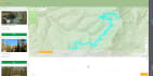
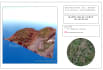
Seeking a skilled mapmaker? This GIG is perfect for you. Leveraging extensive experience in Cartography, Graphic Design, and GIS, I offer comprehensive services in GIS and remote sensing to meet your needs.
- Basic GIS Tasks:
- File Conversion: CAD/KML to SHP/GEODATABASE, Coordinate to Feature.
- Digitization: Create digital maps from raw data, ensuring accuracy and precision.
- Intermediate GIS Services:
- Spatial Analysis: Employ advanced GIS tools for spatial data interpretation.
- Georeferencing: Align disparate geographic data into a coherent framework.
- Hydrology Studies: Analyze water-related phenomena with GIS tools.
- Editor Tool Usage: Utilize specialized GIS editing tools for data management.
- Advanced Geospatial Solutions:
- Geodatabase Management: Organize and manage complex geospatial databases.
- Data Interpolation: Transform discrete data points into continuous surfaces.
- Viewshed Analysis: Analyze visual and physical landscapes.
- Transportation Network Analysis: Examine and optimize transportation systems.
- Web Mapping: Create interactive web maps.
Get to know Ayoub L
Ayoub L
Quality over price Your satisfaction is my guarantee
Level 2
- FromMorocco
- Member sinceJun 2017
- Avg. response time1 hour
- Last delivery4 weeks
Languages
English, Arabic, French, Spanish
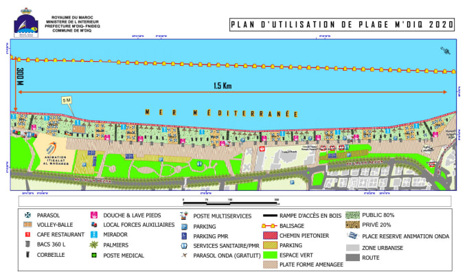
With 5+ years as a GIS Cartographer and Data Analyst, I've completed 100+ projects using ArcGIS, QGIS, Tableau, Power BI, and Adobe Creative Suite. I've served diverse sectors, always focusing on quality. My skills span beyond the technical, ensuring effective communication and project management. My portfolio showcases simple maps to detailed visuals. If you need a high-quality map or visualization, I'm your expert.
Other Data Visualization Services I Offer
FAQ
What is GIS?
GIS is a brief word for Geographic Information System and as meaning, a GIS is: " a computer system for capturing, storing, checking, and displaying data related to positions on Earth's surface. By relating seemingly unrelated data".
Why we create maps?
Because Maps enable you to explore your data and to discover and interpret patterns, in aim to make the best decision.
Reviews
29 reviews for this Gig
| (28) | ||
| (0) | ||
| (0) | ||
| (0) | ||
| (1) |
Rating Breakdown
- Seller communication level
- Recommend to a friend
- Service as described
Sort By
Most relevant
 United Kingdom
Amazing experience. Exceeded exectations. I will definitely work with Ayoub again.
 United States
Ayoub is absolutely wonderful to work with. Looking forward to future project work with him.
 Australia
Excellent work!!!
- United States
10/10. Very professional and talented.
 Canada
Great communication, everything is done completely and work is done very professionally.
Reviews
29 reviews for this Gig
| (28) | ||
| (0) | ||
| (0) | ||
| (0) | ||
| (1) |
Rating Breakdown
- Seller communication level
- Recommend to a friend
- Service as described
Sort By
Most relevant
- United Kingdom
Amazing experience. Exceeded exectations. I will definitely work with Ayoub again.
- United States
Ayoub is absolutely wonderful to work with. Looking forward to future project work with him.
- Australia
Excellent work!!!
- United States
10/10. Very professional and talented.
- Canada
Great communication, everything is done completely and work is done very professionally.
